- Visiting Iceland
- Travel Information
- FAQ
- Protected Areas
- Westfjords
- Breidafjordur
- Dynjandi in Arnarfjordur
- About the area
- Access and services
- Pay for parking
- Nature
- Culture and history
- Drone use at Dynjandi
 Dynjandi in Arnarfjordur
 - Flatey in Breidafjordur
- Hornstrandir
- Hrisey, Reykholahreppur
- Látrabjarg
- For seafarers
Látrabjarg - Surtarbrandsgil
- Vatnsfjordur
Westfjords - North West
- North East
- Boggvistadafjall
- Dettifoss and a row of waterfalls
- Dimmuborgir
- Public park in Glerardalur
- Reservation in Svarfadardalur
- Godafoss in Thingeyjarsveit
- Hraun in Oxnadalur
- Hverastrytur in Eyjafjordur
- Hverfjall
- Krossanesborgir
- Myvatn and Laxa
- Seljahjallagil
- Skutustadagigar
- Vatnajokull National Park
- Vestmannsvatn
North East - West
- Andakill
- Bardarlaug, Snaefellsbaer
- Blautos and Innstavogsnes
- Breidafjordur
- Budahraun
- Einkunnir, Borgarbyggd
- Eldborg in Hnappadalur
- Geitland, Borgarbyggd
- Grabrokargigar, Borgarbyggd
- Grunnafjordur
- Hraunfossar, Borgarbyggd
- Husafellsskogur, Borgarbyggd
- Kalmanshellir
- Melrakkaey
- Stedji (Staupasteinn)
- The coast by Stapi and Hellnir
- Vatnshornsskogur, Skorradalur
- Snaefellsjokull National Park
West - Search by name
- East
- South West
- Akurey
- Alafoss, Mosfellsbaer
- Astjorn, Hafnarfjordur
- Astjorn and Asfjall, Hafnarfjordur
- Bakkatjorn, Seltjarnarnes
- Blafjoll Public Park
- Borgir, Kopavogur
- Bringur, Mosfellsdalur
- Burfell, Gardabaer
- Eldborg in Blafjoll
- Eldborg in Geitahlid
- Eldey, Reykjanesbaer
- The shore by Kasthusatjorn
- Fossvogsbakkar, Reykjavik
- Gardahraun, Gardabaer
- Galgahraun, Gardabaer
- Grotta, Seltjarnarnes
- Hamarinn, Hafnarfjordur
- Haubakkar, Reykjavik
- Hleinar, Hafnarfjordur
- Hlid, Alftanes
- Hvaleyrarlon and Hvaleyrarhofdi
- Kaldarhraun and Gjarnar
- Kasthusatjorn, Alftanes
- Laugaras, Reykjavik
- Litluborgir, Hafnarfjordur
- Raudholar, Reykjavik
- Reykjanes Public Park
- Skerjafjordur, Gardabaer
- Skerjafjordur, Kopavogur
- Stekkjarhraun, Hafnarfjordur
- Trollaborn, Lækjarbotnar
- Tungufoss, Mosfellsbaer
- Valhusahaed, Seltjarnarnes
- Varmarosar, Mosfellsbaer
- Vifilsstadavatn, Gardabaer
- Vigholar, Kopavogur
South West - South
- Alftaversgigar
- Arnahellir in Leitahraun
- Dverghamrar
- Dyrholaey
- Fjallabak Nature Reserve
- Geysir Area
- Gullfoss
- Herdisarvik
- Jorundur in Lambahraun
- Kerlingarfjoll
- Kirkjugolf
- Oddaflod
- Pollengi and Tunguey
- Skogafoss
- Surtsey
- Area in Thjorsardalur
- Vatnajokull National Park
- Videy in Thjorsa
- Thingvellir National Park
- Thjorsarver
South - Mývatn and Laxá
- National Parks
Protected Areas - Westfjords
- Permits in protected areas
- Operational licence
- Photography, cinematography and drone flying
- Research permit
Permits in protected areas - Drones in protected areas
- Guidelines for using drones in protected areas
- Flights in protected areas
- Apply for permit
Drones in protected areas - Volunteers
- Snæfellsjökull National Park
Visiting Iceland - Wildlife
- Air & Climate
- Ocean & Water
- Industry
- Chemicals
- Frequently asked questions
- Biocides
- Classification and labelling – CLP
- Cosmetics
- Detergents
- Fluorinated greenhouse gases (F-gases)
- Fuel
- Certificate for pest control
- Certificate for professional use of plant protection products
- Plant protection products
- POPs
- REACH
- Safety data sheets
- Supervision, inspection and coercive measures
Frequently asked questions - Biocides
- Classification and labelling
- CLP
- Classification
- Labelling
- Packaging and retention
Classification and labelling - Cosmetics
- Detergents
- F-gases
- Fuel
- Plant protection products
- Authorisation
- Harmonised Risk Indicators
Plant protection products - POPs
- REACH
- Fees
Chemicals - Frequently asked questions
- Importation of Alien Species
- ETS
Industry - Chemicals
- Circular Economy
- Waste
- Waste Management
Circular Economy - The Agency
Vinna við nýjar heimasíður Umhverfis- og orkustofnunar og Náttúruverndarstofnunar er í gangi. Heimasíða Umhverfisstofnunar er virk á meðan vinnunni stendur. Information in English
.svg)
Hiking trails
Hörgsnes
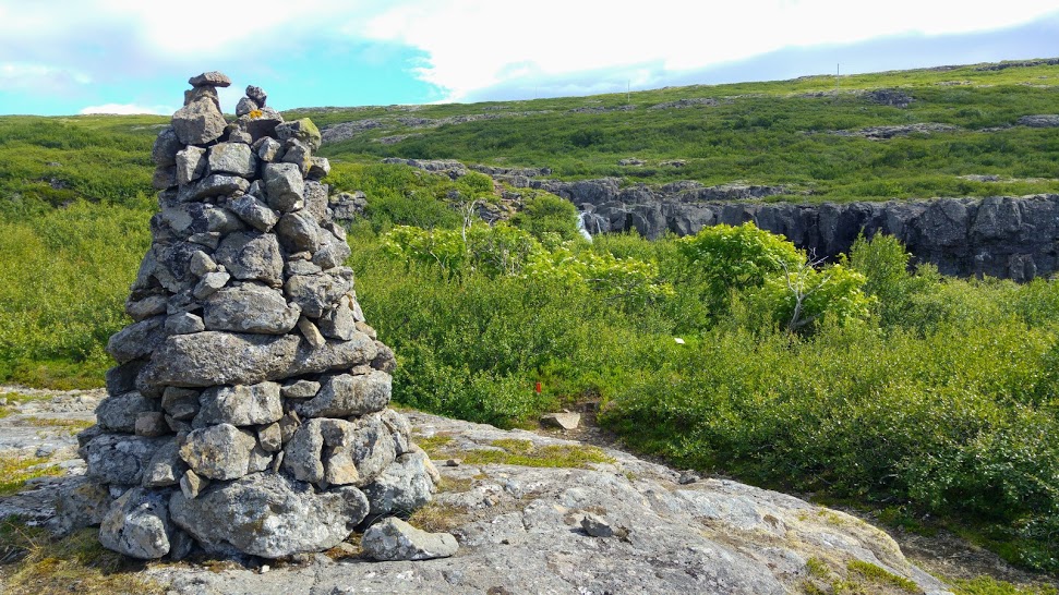
A marked circular route runs from the Hörgsnes parking lot to the cliff Hörgur and Gíslahellir, where one can find beautiful views over Breiðafjörður and often see seals sunning themselves on the skerries on the beach.
Around 500 m, 30 minutes – 1 hour. Elevation 50 m.
Smiðjutóftin
From the roots of the old road on Þingmannaheiði, you can get to Smiðjutóftin, protected archaeological remains named after Gestur spaki Oddleifsson. The remains are approx. two hundred meters above the Ring Road, west of Þingmannaá.
Around 500 m, 30 minutes – 1 hour. Elevation 10 m.
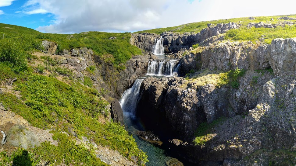
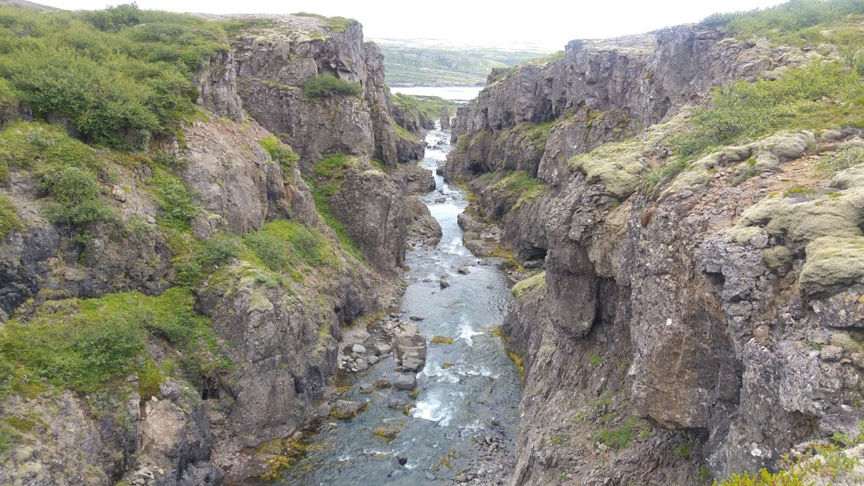
Þingmannaá and Nafnlausi fossinn
From the recess at the root of Þingmannaheiði is a marked circular route that runs along the banks of Þingmannaá and back down to the old road. Here you can see beautiful views over the river canyon and “Nafnlausi fossinn” (the Nameless Waterfall), stately cairns and pretty ash trees. At the top of the trail, you can see neat potholes in the rocks by the river.
Around 500 m, 30 minutes – 1 hour. Elevation 200 m.
Þingmannaheiði
This is an ancient public road that runs between Vatnsfjörður and Vattarfjörður and is adorned with beautiful cairns; a part of the road is within the nature reserve. A rough vehicle road was built over the heath in 1951 and is passable on foot; it occasionally follows the old road and the row of cairns.
24 km, 6 hours. Elevation 500 m.
Lambagil
A marked circular route runs from the recess for cars by the roots of Þingmannaheiði to the old forestry, into Vatnsdalur to Lambagil and along Vatnsdalsvatn over Mörkin, offering beautiful views over Vatnsdalsvatn and diverse landscape. East of the lake in Lambagilseyrar, birch grows higher than anywhere else in the Westfjords.
5 km, 3 hours. Elevation 200 m.
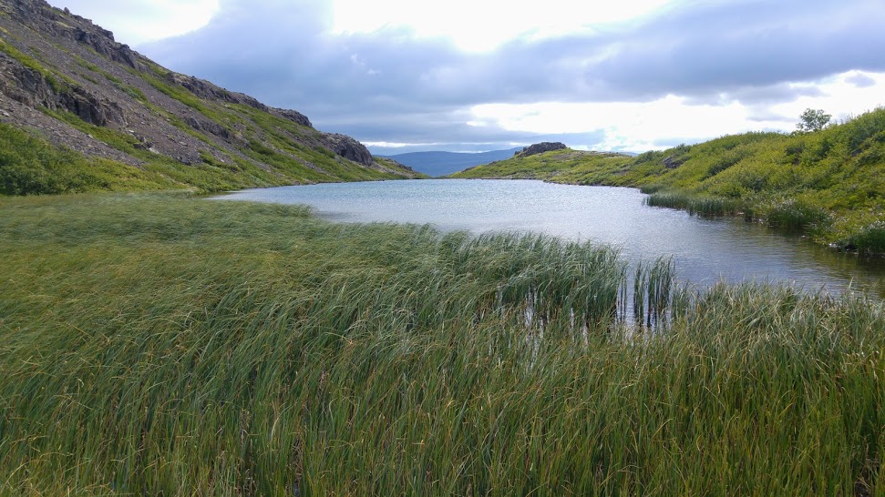
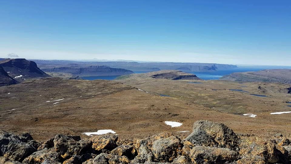
Vatnsdalsvatn and Vatnsdalur
There are many hiking opportunities in Vatnsdalur, and it’s easy to find a suitable trail. The circular route around the lake is 9 km long, but shorter trails are available to suit the interest and resilience of each individual. From where the road ends by the northern part of Vatnsdalsvatn, it’s about 3 km to the heart of the valley where you can see beautiful waterfalls. Vatnsdalsá and Útnorðursár that flow into the heart of the valley to the west are usually difficult to cross and can be dangerous. Visitors should not be in Vatnsdalur when herding is in progress in the fall, mainly to prevent them from leading the sheep that are being herded astray.
Smalahellan
From the Vatnsdalur parking lot where the road ends, a marked trail leads to Smalahellan. It’s a barren patch in the mountain where spring water flows down and smooths the steep cliff. According to legend, sheep herders in the area were considered skilful if they could run over the slippery cliff.
1.2 km, 30 minutes – 1 hour, no elevation.
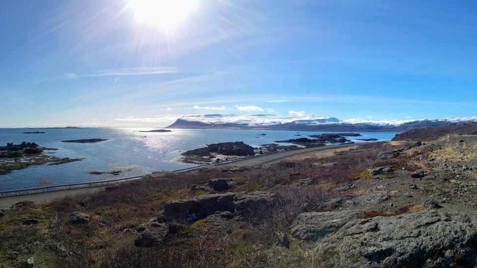
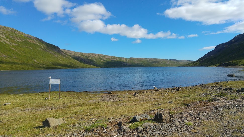
Helluvatn
A marked hiking trail runs from Flókalundur to Helluvatn north of Flókalundur. The ascent has beautiful views over Vatnsfjörður. Once you reach the lake, you can extend the walk by going around the lake.
6 km (9 km if you walk around the lake), 3–4 hours, elevation 300 m.
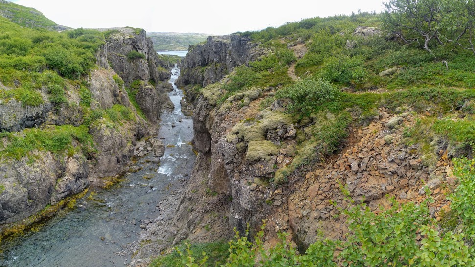
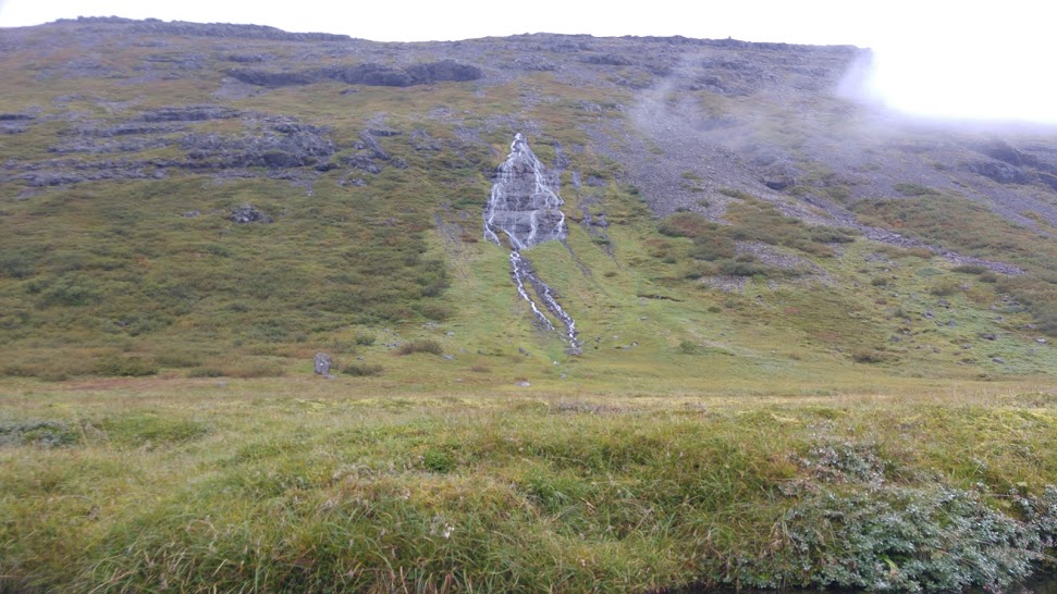
Pennugil
From the parking lot by the lower bridge in Penna, an easy hiking trail is marked along the river canyon to a beautiful waterfall. On the way, you’ll see interesting rock formations in the canyon.
2 km, 1 hour, elevation 50 m.
Lónfell
From the sign that marks the beginning of the hiking trail in Dynjandaheiði runs a marked and rocky trail to Lónfell. The mountain is sometimes called the baptismal font of Iceland, as many think it’s probable that this is where Hrafna-Flóki named Iceland. It offers good views over Breiðafjörður and the southern Westfjords highlands. Sparse vegetation and wilderness is a change from the vegetated lowlands. Hiking from Helluskarð is also possible, and the views on that hike are quite different, as it looks down into the fjords from the north.
5–6 km, 3 hours, Elevation 300 m.