Vinna við nýjar heimasíður Umhverfis- og orkustofnunar og Náttúruverndarstofnunar er í gangi. Heimasíða Umhverfisstofnunar er virk á meðan vinnunni stendur. Information in English
Seljahjallagil

Seljahjallagil, Bláhvammur, Þrengslaborgir and surroundings in Skútuhreppur were protected as a natural monument in 2012. The aim of the protection of Seljahjallagil, Bláhvammur, Þrengslaborgir and surroundings as a natural monument is to preserve distinctive geological formations, in addition to which the area has a high educational and outdoor activities value. The natural monument also partly covers the habitat protection of falcons in Mývatnssveit.
The natural monument contains significant relics from the volcanic eruptions that formed Mývatn and its surroundings. The older Laxárhraun flowed from Ketildyngja through Seljahjallagil nearly 4,000 years ago, spread out in the Mývatn area and continued down Laxárdalur and into Aðaldalur. This created a blockage in the Mývatn area’s runoff, forming a lake similar in size to Lake Mývatn, but with a different shape. Around 2,300 years ago, the younger Laxárhraun flowed from Lúdentaborgir, Þrengslaborgir and Borgir in Grænavatnsbruni. One of the craters from this eruption is in Seljahjallagil. The lava flowed through the Mývatn area, down Laxárdalur and Aðaldalur and all the way to Skjálfandi. Dimmuborgir was formed in this eruption, as were pseudo craters by Mývatn, in Laxárdalur and in Aðaldalur. The eruption formed Mývatn in its present form.
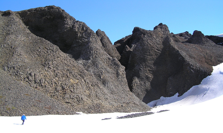
Bláfjall and the Bláfjall mountain range contain diverse tuft and basalt formations from the ice age, with ravines and ridges that were carved out at the end of the period. Seljahjallagil is 100–150 m deep in many places and around 500 m wide on average. Melt water has carved out a new canyon at the northernmost part of the canyon through the lava, with great rock stacks that have some of the most beautiful columnar basalt in the east of North Iceland. Bláhvammur is a vegetated hilly area south of Seljahjallagil with birch forest and flowers. The hollow is a rocky cirque that glacial water has carved out of the tuft, and it has a clearly visible old waterfall site. In the natural monument, you will also find falcon eyries that are occupied every year.
The protected area covers an area of 1,880.7 ha.