- Visiting Iceland
- Travel Information
- FAQ
- Protected Areas
- Westfjords
- Breidafjordur
- Dynjandi in Arnarfjordur
- About the area
- Access and services
- Pay for parking
- Nature
- Culture and history
- Drone use at Dynjandi
overlayDynjandi in Arnarfjordur
- Flatey in Breidafjordur
- Hornstrandir
- Why is the area protected?
- Useful information
- Administration
- Hiking trails
overlayHornstrandir
- Hrisey, Reykholahreppur
- Látrabjarg
- For seafarers
overlayLátrabjarg
- Surtarbrandsgil
- Vatnsfjordur
- About the area
- Access and services
- Culture and history
- Hrafna-Flóki and Flókatóftir
- Gíslahellir
- Þingmannaheiði
overlayCulture and history
- Nature and geology
- Hiking trails
overlayVatnsfjordur
overlayWestfjords
- North West
- North East
- Boggvistadafjall
- Dettifoss and a row of waterfalls
- Dimmuborgir
- Public park in Glerardalur
- Reservation in Svarfadardalur
- Godafoss in Thingeyjarsveit
- Hraun in Oxnadalur
- Hverastrytur in Eyjafjordur
- Hverfjall
- Krossanesborgir
- Myvatn and Laxa
- Seljahjallagil
- Skutustadagigar
- Vatnajokull National Park
- Vestmannsvatn
overlayNorth East
- West
- Andakill
- Bardarlaug, Snaefellsbaer
- Blautos and Innstavogsnes
- Breidafjordur
- Budahraun
- Einkunnir, Borgarbyggd
- Eldborg in Hnappadalur
- Geitland, Borgarbyggd
- Grabrokargigar, Borgarbyggd
- Grunnafjordur
- Hraunfossar, Borgarbyggd
- Husafellsskogur, Borgarbyggd
- Kalmanshellir
- Melrakkaey
- Stedji (Staupasteinn)
- The coast by Stapi and Hellnir
- Vatnshornsskogur, Skorradalur
- Snaefellsjokull National Park
overlayWest
- Search by name
- East
- South West
- Akurey
- Alafoss, Mosfellsbaer
- Astjorn, Hafnarfjordur
- Astjorn and Asfjall, Hafnarfjordur
- Bakkatjorn, Seltjarnarnes
- Blafjoll Public Park
- Borgir, Kopavogur
- Bringur, Mosfellsdalur
- Burfell, Gardabaer
- Eldborg in Blafjoll
- Eldborg in Geitahlid
- Eldey, Reykjanesbaer
- The shore by Kasthusatjorn
- Fossvogsbakkar, Reykjavik
- Gardahraun, Gardabaer
- Galgahraun, Gardabaer
- Grotta, Seltjarnarnes
- Hamarinn, Hafnarfjordur
- Haubakkar, Reykjavik
- Hleinar, Hafnarfjordur
- Hlid, Alftanes
- Hvaleyrarlon and Hvaleyrarhofdi
- Kaldarhraun and Gjarnar
- Kasthusatjorn, Alftanes
- Laugaras, Reykjavik
- Litluborgir, Hafnarfjordur
- Raudholar, Reykjavik
- Reykjanes Public Park
- Skerjafjordur, Gardabaer
- Skerjafjordur, Kopavogur
- Stekkjarhraun, Hafnarfjordur
- Trollaborn, Lækjarbotnar
- Tungufoss, Mosfellsbaer
- Valhusahaed, Seltjarnarnes
- Varmarosar, Mosfellsbaer
- Vifilsstadavatn, Gardabaer
- Vigholar, Kopavogur
overlaySouth West
- South
- Alftaversgigar
- Arnahellir in Leitahraun
- Dverghamrar
- Dyrholaey
- Fjallabak Nature Reserve
- About the nature reserve
- Access and services
- Landmannalaugar
- Reservations
- FAQ
- About the area
overlayLandmannalaugar
- Outdoor activities and hiking trails
- Nature and geology
- Culture and history
overlayFjallabak Nature Reserve
- Geysir Area
- Gullfoss
- About the area
- Nature and geology
- Culture and history
overlayGullfoss
- Herdisarvik
- Jorundur in Lambahraun
- Kerlingarfjoll
- General information
- The protected area
- Access and services
- Outdoor activities and hiking trails
- Information
- Geology
- Mountain peaks
- Flora and Fauna
overlayInformation
overlayKerlingarfjoll
- Kirkjugolf
- Oddaflod
- Pollengi and Tunguey
- Skogafoss
- About the area
- Culture and history
- Access and management
overlaySkogafoss
- Surtsey
- Protection
- Research
- Mapping and surveilance
overlaySurtsey
- Area in Thjorsardalur
- Vatnajokull National Park
- Videy in Thjorsa
- Thingvellir National Park
- Thjorsarver
- About the nature reserve
- Nature and geology
- History and utilization
overlayThjorsarver
overlaySouth
- Mývatn and Laxá
- About Mývatn
- Visitor center
- Flora and Fauna
- Archeology and Folklore
- Geology
overlayMývatn and Laxá
- National Parks
overlayProtected Areas
- Westfjords
- Permits in protected areas
- Operational licence
- Photography, cinematography and drone flying
- Research permit
overlayPermits in protected areas
- Drones in protected areas
- Guidelines for using drones in protected areas
- Flights in protected areas
- Apply for permit
overlayDrones in protected areas
- Volunteers
- Snæfellsjökull National Park
overlayVisiting Iceland
- Wildlife
- Air & Climate
- Air pollution during a volcanic eruption
- EU ETS
overlayAir & Climate
- Ocean & Water
- Industry
- Chemicals
- Frequently asked questions
- Biocides
- Classification and labelling – CLP
- Cosmetics
- Detergents
- Fluorinated greenhouse gases (F-gases)
- Fuel
- Certificate for pest control
- Certificate for professional use of plant protection products
- Plant protection products
- POPs
- REACH
- Safety data sheets
- Supervision, inspection and coercive measures
overlayFrequently asked questions
- Biocides
- Biocidal products
- Fees
- FAQ
- National transitional requirements
overlayBiocides
- Classification and labelling
- CLP
- Classification
- Labelling
- Packaging and retention
overlayClassification and labelling
- Cosmetics
- Detergents
- F-gases
- Fuel
- Plant protection products
- Authorisation
- Harmonised Risk Indicators
overlayPlant protection products
- POPs
- REACH
- Fees
overlayChemicals
- Frequently asked questions
- Importation of Alien Species
- ETS
overlayIndustry
- Chemicals
- Circular Economy
- Waste
- Waste Management
overlayCircular Economy
- The Agency
- About the EAI
- Departments
- Responsibilities
- Nature
- Wildlife
- Air & Climate
- Chemicals
- Ocean & Water
- Industry
- Circular Economy
overlayResponsibilities
- Values and policy
- Act on the EAI
- Contact us
overlayThe Agency
overlay
- Visiting Iceland
- Wildlife
- Air & ClimateAir & Climate
- Ocean & Water
- Industry
- Circular EconomyCircular Economy
- The Agency
Vinna við nýjar heimasíður Umhverfis- og orkustofnunar og Náttúruverndarstofnunar er í gangi. Heimasíða Umhverfisstofnunar er virk á meðan vinnunni stendur. Information in English
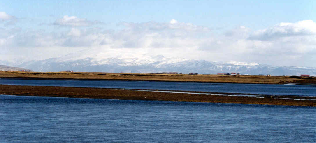
Oddaflod

Oddaflóð was protected in 1994. These are wetlands with a robust birdlife.
The nature reserve covers an area of 568.4 ha.