Vinna við nýjar heimasíður Umhverfis- og orkustofnunar og Náttúruverndarstofnunar er í gangi. Heimasíða Umhverfisstofnunar er virk á meðan vinnunni stendur. Information in English
Nature and geology

Hveravellir is located on Kjölur, the area between Langjökull and Hofsjökull glaciers in the Highlands, within Austur-Húnavatnssýsla county. The landscape of Kjölur was formed by glaciers during the ice age, which ended around 12,000 years ago. All mountains in Kjölur are originally volcanoes, and it’s mostly tuyas and and shield volcanoes that rise up from the highland plain and characterise the landscape. The tuyas, e.g. Hrútfell, Kjalfell and Bláfell, were formed through sub-glacial volcanic activity. Shield volcanoes include Kjalhraun and Baldheiði, which were formed in large eruptions outside the glacier. Kjalhraun flowed approx. 8,000 years ago, and the lava field covers around 180 square kilometres. Hveravellir sits in a hollow north of the lava field, approx. 630 m above sea level. The Kerlingarfjöll rhyolite mountains are also a distinctive feature of Kjölur and are the remains of an ancient central volcano.
Geothermal Power
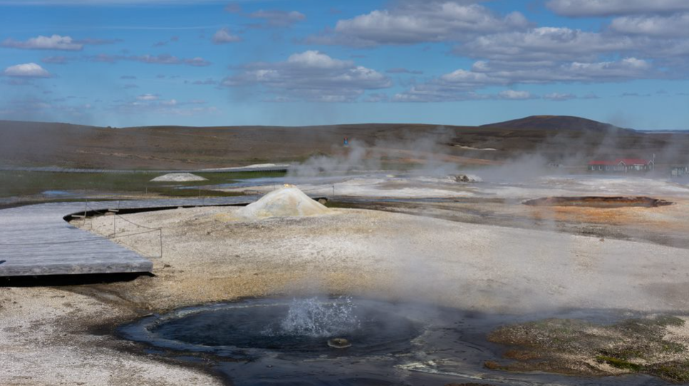
Hveravellir is a high-temperature geothermal area, one of about 20 such areas in the country. High-temperature areas are tied to the volcanic belts and are usually categorised as such if the geothermal temperature is at least 150°C at a depth of 1,000 m. The groundwater in Hveravellir is rather high, and therefore, hot springs are mainly found there, although there are some geysers and colourful encrustations. The steam forms where the water boils underground before it reaches the surface.
In high-temperature areas there is a large amount of dissolved solids in the hot spring water. When the water rises to the surface and cools, the solids precipitate and encrustations form. The Hveravellir geothermal area has an unusual amount of encrustations and very colourful ones, and the growth of thermophilic algae in the hot water only adds to the stunning colour palette. The encrustations are mainly sillicon, but they also contain compounds of sulphur and gypsum.
Signs of geothermal heat on the surface can be seen all over the Hveravellir area. The remains of an ancient geothermal area are in the lava field south of the camping grounds, where the ground is hot and fumaroles and heat from lava fissures is common. Warm streams and small springs can be found in occasional spots both north and west of the geothermal area.
Flora and Fauna
As a rule, the fauna in the Icelandic highlands is not very diverse. Birdlife around Hveravellir and the northern part of Kjölur, however, is rather robust. The song of the snow bunting and dunlin can often be heard, and golden plovers and meadow pipits are common in the vegetation around the geothermal area. The pink-footed goose is common in the area, as Hveravellir is located near the biggest pink-footed goose nesting site in the world.
From the northern part of Iceland, there is almost continuous vegetation cover from the lowlands and south up to Kjölur to Hveravellir, but it is sometimes disrupted by gravel plains and ridges. Vegetation at Hveravellir shows that the growth period is short, and snow-patch varieties such as creeping sibbaldia and alpine arctic cudweed are common, as are various other species such as alpine lady’s mantle. Common cotton grass grows in abundance in a strip of wetlands north of the geothermal area, as well as marsh arrow-grass. The ground in the old geothermal area south of the stream is warm in places and that affects the vegetation. More fertile areas are found to the north and west, where luxuriant Iceland Moss is common.