Vinna við nýjar heimasíður Umhverfis- og orkustofnunar og Náttúruverndarstofnunar er í gangi. Heimasíða Umhverfisstofnunar er virk á meðan vinnunni stendur. Information in English
Hiking trails

Please note that walking times are estimated, starting at Hveravellir or other places of origin.
The hot spring area
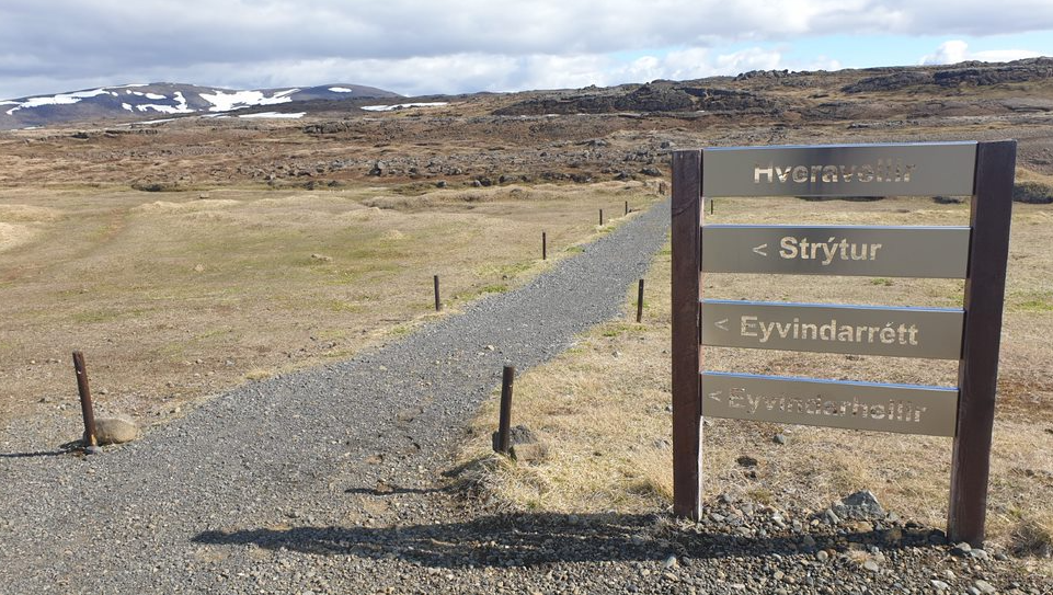
Please stay on the wooden footpaths in the area, starting at the older FÍ hut. After inspecting the hot springs, one can look at Eyvindartóft and the old shelter at the side of the lava. 15-30 minutes.
Eyvindarhellir and Eyvindarrétt (The Cave of Eyvindur and the Eyvindur Fold)
Proceed along the old shelter hut and follow the signposts to a small cave opening in a lava mound. This is Eyvindarhellir. From there, proceed to a large lava mound with a ravine that has been blocked off and is name Eyvindarrétt. 30-45 minutes.
Strýtur (Cones)
Strýtur are a part of the rim of the large crater at the top of Kjalhraun at 840 metres above sea level. There is a marked path from Hveravellir, 3-4 hours.
Dúfunesfell
A 730-metre mountain north-east of Hveravellir, providing a good view of the surroundings. The Landnáma saga speaks of a competitive horse race south of the mountain. It takes 30 minutes to go there from the Kjalvegur road, but from Hveravellir it is 3-4 hours.
Around Stélbrattur – Þjófadalafjöll
Proceed along the Þegjandi river to the north of Stélbrattur in the direction of Oddnýjarhnjúkur in the Þjófadalafjöll (Þjófadalir mountains), 1,067 metres above sea level. The mountains contain beautiful canyons. From Oddnýjarhnjúkur there is a great view over Langjökull. The walk takes 6-8 hours but can be shortened to 3-4 hours by only going to Stélbrattur.
Þjófadalir – Rauðkollur
A jeep track is open in late summer to Þröskuldur above Þjófadalir. Please note that one cannot drive into the valleys due to protection of vegetation. There are many enjoyable footpaths from Þjófadalir, such as up to Þverfell and Rauðkollur, 1,075 metres. From Rauðkollur, one can continue north and east along the mountain ridge back to Þröskuldur.
Rjúpnafell and Grettishellir
Walk east along the old Kjalvegur road. Alongside the road, about 2 km south of Rjúpnafell, there is a large lava mound with many cairns. It has a cave that is open at both ends, named Grettishellir (the Cave of Grettir). There is a good view over the Kjölur area from the top of Rjúpnafell. 5-7 hours.
Beinahóll (Bone Mound)
The death of the Reynistaðir brothers and their companions is well known. They died on the Kjalvegur road in 1780. Beinhóll draws its name from bone remains of sheep and their horses, and a memorial is on top of the mound. Leave bone remains untouched.
One can drive a marked jeep track shortly south of Fjórðungsalda (Geirsalda with the ring display) as far as possible and continue from there by foot. The same track back or along a path marked by cairns to the north, passing by Grettishellir and from there to Hveravellir. 4-5 hours, including a walk to Hveravellir, otherwise 2 hours.
Hvítárnes – Hveravellir
The track lies between the huts of the Iceland Touring Association, mostly on the old Kjalvegur road. One begins at the Hvítárnes hut, the oldest shelter of the Touring Association (30 beds). The first leg is to the hut at Þverbrekknamúli (20 beds), 4-5 hours. The second leg is to Þjófadalir (12 beds), 4-5 hours, and the final leg is to Hveravellir, 3-4 hours.