Vinna við nýjar heimasíður Umhverfis- og orkustofnunar og Náttúruverndarstofnunar er í gangi. Heimasíða Umhverfisstofnunar er virk á meðan vinnunni stendur. Information in English
Geology

The Mývatn area is on the boundary of the North American and Eurasian plate. They drift about 2 cm apart each year, and lava wells up and fills the rift. This has caused great volcanic activity here through the ages.
Mt. Hverfjall (Hverfell)
Mt. Hverfjall (Hverfell) is a beautifully formed 2500 years old tephra crater. The crater is about 1 km in diameter and 140 meters deep. The round shape of the crater is disrupted by a landslide that occurred at the south edge of the crater during the eruption. In the Settlement period, lava flowed from Svörtuborgir almost encircling Hverfjall (Hverfell). At the same time, Mt. Dalfjall erupted. Craters of the same type as Hverfjall are uncommon in the world, but there is another crater, Lúdentarskál crater, which is much older, southeast of Mt. Hverfjall (Hverfell).
The Yngra-Laxárhraun Lava Field
A great eruption occurred in a 12-km-long fissure south of Mt. Hverfjall (Hverfell) 2300 years ago. Several bizarre formations are in this lava, which has been called the Younger-Laxárhraun lava field. A great row of craters called Lúdentarborgir was formed on the fissure. Þrengslaborgir is the name of two prominent craters towards the south of the fissure. The Younger-Laxárhraun flowed over most of Mývatnssveit district and covered and destroyed a large lake. The lava then flowed on through Laxárdalur valley, reaching the sea through Aðaldalur valley. Wherever the lava encountered lakes and wetland, steam explosions formed craters. Such craters are called pseudocraters since they are not outlets for lava but steam. There are clusters of beautiful pseudocraters all around Mývatn and also in Laxárdalur and Aðaldalur valleys. Many of the craters are double and some even triple. The largest are found near Mt. Vindbelgur.
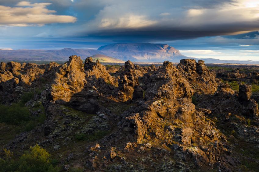
Dimmuborgir
Dimmuborgir is a very peculiar lava formation. A pool of lava, about 2 kilometers in diameter, formed there during an eruption in Lúdentarborgir. This pool later drained in the direction of lake Mývatn, leaving behind high pillars of lava. It is believed that these pillars were formed in the pool when steam rose through the molten lava and cooled it. The sinking surface also coated the pillars with lava slag, which can be seen in many places as a thin coating with vertical etchings. Lava formations like Dimmuborgir have been found off the coast of Mexico, but are not known to exist on dry land anywhere but here. The lava pillars at Höfði (Klasar and Strípar) are similar formations.
The Krafla Volcanic Area
The Leirhnjúkur area is a central volcano. One hundred thousand years ago, there was a volcanic cone here that caved in after erupting. The caldera thus formed is now filled with younger volcanic material. Below at a depth of about 3 km, however, is a magma chamber. Volcanic activity in the area occurs at intervals of several centuries. Magma flows into the chamber, which expands and raises the ground. The chamber then bursts and magma flows through underground fissures to the north or south. A part of the magma may then surface in an eruption. As the pressure in the magma chamber decreases, the land subsides quickly. This process repeats itself every few months for several years running. The Mývatnseldar eruptions (the “Mývatn fires”) in 1724 began with a great volcanic explosion which formed the crater Stóra - Víti. In the following years, a series of earthquakes and eruptions occurred in the vicinity of Mt. Krafla. The greatest eruption took place in 1729, when lava flowed from Leirhnjúkur down to Mývatn lake. Eldhraun, the lava field formed during the eruptions. A new series of eruptions (the "Krafla-fires") began in Krafla in 1975, after an intermission of about 250 years. In the following nine years, nine eruptions occurred.